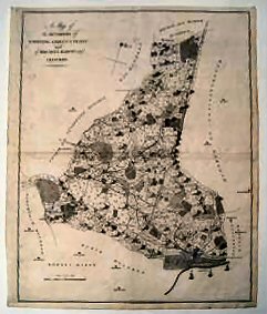
A Map Of The Hundred Of Stowting, Street And Heane And Of Bircholt Barony And Franchise..
Traces of old folds, otherwise a very good example.
£110.00
Publisher
Canterbury. n.d. but,
Date
1778-1801.
Item Description
Uncoloured copper-engraved map (engraved area 15 x 18 inches) with good margins. Scale 1¼ inches to one mile.
Notes
This sheet shows from outside Waltham the land to the left of Stone Street, with Elmsted, Hastingleigh, Braborne and Stowting in the north with Sellinge, Aldington, Stanford and Lympne in the centre, and Saltwood and the town of Hythe in the south and the sea forming the southern border.
[Stock No. 16203]
Subjects
18th Century • Kent • Maps • Topography