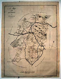
A Map Of The Hundred Of Twyford..
A very good copy.
£75.00
Publisher
Canterbury. n.d. but,
Date
1778-1801.
Item Description
Uncoloured copper-engraved map (engraved area 15 x 19 inches) with good margins. Scale 2 inches to one mile.
Notes
The sheet shows the confluence of the Medway and Bewle rivers at Yalding with Wateringbury to the north and West Farleigh to the east and North Hatch to the west, and Brenchley in the south.
[Stock No. 10451]
Subjects
18th Century • Kent • Maps • Topography