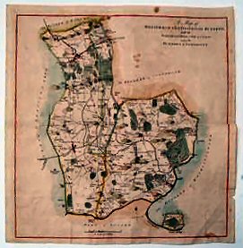
A Map Of The Hundred Of Westerham And Eatonbridge Hundred, With The Parish And Ville Of Brasted: And The Hundred Of Somerden..
A very good copy.
£110.00
Publisher
Canterbury, n.d. but,
Date
1778-1801.
Item Description
Hand-coloured copper engraved map (engraved area 15 x 15 inches) with good margins. Scale 1¼ inches to one mile.
Notes
The sheet shows Westerham and Brasted in the north, Eatonbridge, Hever, Chidingstone and Penshurst in the centre, with Cowden in the south.
[Stock No. 19140]
Subjects
18th Century • Kent • Maps • Topography